Woodhull, Illinois
| Woodhull | |
| village | |
| Land |  USA USA |
|---|---|
| Delstat | Illinois |
| County | Henry County |
| Koordinater | 41°10′42″N 90°19′19″V / 41.17833°N 90.32194°V / 41.17833; -90.32194 |
| Yta | 2,1 km² (2010)[1] |
| - land | 2,1 km² |
| - vatten | 0 km² |
| Folkmängd | 810 (2011)[2] |
| Befolkningstäthet | 386 invånare/km² |
| Tidszon | CST (UTC-6) |
| - sommartid | CDT (UTC-5) |
| ZIP-kod | 61490[3] |
| FIPS | 1783063 |
| Geonames | 4917020 |
  Ortens läge i Illinois | |
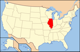 Illinois läge i USA | |
Woodhull är en by i Henry County i den amerikanska delstaten Illinois med en yta av 2 km² och en folkmängd som uppgår till 811 invånare (2010). I 2000 års folkräkning var byns folkmängd 809 invånare.[4]
Kända personer från Woodhull
- Don Samuelson, politiker, guvernör i Idaho 1967-1971
Referenser
- ^ ”2010 Census Gazetteer Files”. US Census Bureau. Arkiverad från originalet den 14 juli 2012. https://www.webcitation.org/699nOulzi?url=http://www.census.gov/geo/www/gazetteer/files/Gaz_places_national.txt. Läst 14 juli 2012.
- ^ ”Annual Estimates of the Resident Population for Incorporated Places: April 1, 2010 to July 1, 2011”. Arkiverad från originalet den 1 augusti 2012. https://www.webcitation.org/69axJf1Co?url=http://www.census.gov/popest/data/cities/totals/2011/tables/SUB-EST2011-03-17.csv. Läst 1 augusti 2012.
- ^ ”2010 ZIP Code Tabulation Area (ZCTA) Relationship Files”. U.S. Census Bureau. 30 juni 2010. Arkiverad från originalet den 25 augusti 2012. https://www.webcitation.org/6ABdwXxbq?url=http://www.census.gov/geo/www/2010census/zcta_rel/zcta_place_rel_10.txt. Läst 25 augusti 2012.
- ^ Woodhull village, Illinois. Census 2000 demographic profile highlights. U.S. Census Bureau. Läst 20 december 2011.


