Talas District, Kazakhstan
District in Jambyl Region, Kazakhstan
Talas Талас | |
|---|---|
District | |
| Talas аudany | |
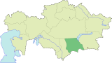
 Location of Talas District, Kazakhstan in Kazakhstan | |
| Coordinates: 43°48′N 70°43′E / 43.800°N 70.717°E / 43.800; 70.717 | |
| Country |  Kazakhstan Kazakhstan |
| Region | Jambyl Region |
| Administrative center | Karatau |
| Population (2013) | |
| • Total | 52,090 |
| Time zone | UTC+6 (East) |
Talas (Kazakh: Талас ауданы, Talas audany) is a district of Jambyl Region in south-eastern Kazakhstan. The administrative center of the district is the town of Karatau.[1]
Geography
Akkol village and Lake Akkol are located in the district.[2][3]
References
- v
- t
- e
Jambyl Region
Capital: Taraz
 | This Kazakhstan location article is a stub. You can help Wikipedia by expanding it. |
- v
- t
- e


