Puerto Rico Highway 21
Highway in Puerto Rico
Major junctions
 PR-19 in Gobernador Piñero
 PR-20 in Monacillo Urbano–Gobernador Piñero
 PR-841 in Gobernador Piñero–Monacillo Urbano
 PR-18 in Monacillo Urbano

 PR-1 / PR-176 in El Cinco
←  PR-20 PR-20 | →  PR-22 PR-22 |
Puerto Rico Highway 21 (PR-21) is the main highway to get to the Medical Center and Veterans Hospital in San Juan, Puerto Rico. It begins at PR-19 in Guaynabo to San Juan before ending at PR-1.[2][3]
- Puerto Rico Highway 21
-
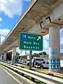
 Heading west
 -
 Westbound sign


History
PR-6 was previously numbered as PR-21. Perhaps there were plans to connect current PR-21 to current PR-6, but such plans were never realized.
Major intersections
The entire route is located in San Juan.


| Location | km[1] | mi | Destinations | Notes | |
|---|---|---|---|---|---|
| Gobernador Piñero | 5.0 | 3.1 |  PR-19 (Avenida Luis Vigoreaux) – Guaynabo PR-19 (Avenida Luis Vigoreaux) – Guaynabo | Western terminus of PR-21 | |
| Gobernador Piñero–Monacillo Urbano line | 4.8– 4.7 | 3.0– 2.9 | PR-20 (Expreso Rafael Martínez Nadal) – Guaynabo | No entrance ramp to PR-20 northbound | |
| 3.4 | 2.1 |  PR-841 (Calle San Ignacio) – Guaynabo PR-841 (Calle San Ignacio) – Guaynabo | |||
| Monacillo Urbano | 2.4 | 1.5 |  PR-Avenida José de Diego – San Juan, Puerto Nuevo PR-Avenida José de Diego – San Juan, Puerto Nuevo | Eastern terminus of PR-21 through Carretera Roberto Clemente Walker;[4] western terminus of PR-21 through Avenida Ingeniero José "Kiko" Custodio | |
| 1.5 | 0.93 | PR-Avenida Centro Médico – San Juan | Partial cloverleaf interchange | ||
| 1.2– 1.1 | 0.75– 0.68 |  PR-18 (Expreso Las Américas) – San Juan, Caguas, Ponce PR-18 (Expreso Las Américas) – San Juan, Caguas, Ponce | PR-18 exits 7A and 7B; partial cloverleaf interchange | ||
| El Cinco | 0.0 | 0.0 |  PR-1 (Carretera Felipe "La Voz" Rodríguez) / PR-176 south (Avenida Ana G. Méndez) – Río Piedras, Caguas PR-1 (Carretera Felipe "La Voz" Rodríguez) / PR-176 south (Avenida Ana G. Méndez) – Río Piedras, Caguas | Eastern terminus of PR-21 | |
1.000 mi = 1.609 km; 1.000 km = 0.621 mi
| |||||
See also
 Puerto Rico portal
 U.S. Roads portal

References
- ^ a b Google (28 February 2020). "PR-21" (Map). Google Maps. Google. Retrieved 28 February 2020.
- ^ National Geographic Maps (2011). Puerto Rico (Map). 1:125,000. Adventure Map (Book 3107). Evergreen, Colorado: National Geographic Maps. ISBN 978-1566955188. OCLC 756511572.
- ^ Puerto Rico Department of Transportation and Public Works. "Datos de Transito 2000-2009" (in Spanish). Archived from the original on 1 April 2019. Retrieved 29 March 2019.
- ^ "Para designar con el nombre de Roberto Clemente Walker la carretera PR-21, desde la intersección de la Avenida De Diego hasta la intersección de la carretera PR- 19, en San Juan, Puerto Rico". LexJuris (Leyes y Jurisprudencia) de Puerto Rico (in Spanish). 2020. Retrieved 29 December 2020.
External links
 Media related to Puerto Rico Highway 21 at Wikimedia Commons
- v
- t
- e
 | This Puerto Rico road-related article is a stub. You can help Wikipedia by expanding it. |
- v
- t
- e


