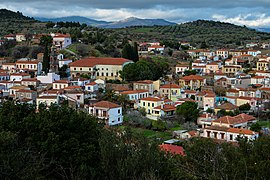
Polichnitos
Municipal unit in Greece
Polichnitos Πολίχνιτος | |
|---|---|
 | |
| 39°05′N 26°11′E / 39.083°N 26.183°E / 39.083; 26.183 | |
| Country | Greece |
| Administrative region | North Aegean |
| Regional unit | Lesbos |
| Municipality | West Lesbos |
| Area | |
| • Municipal unit | 172.6 km2 (66.6 sq mi) |
| Population (2021)[1] | |
| • Municipal unit | 3,438 |
| • Municipal unit density | 20/km2 (52/sq mi) |
| • Community | 2,041 |
| Time zone | UTC+2 (EET) |
| • Summer (DST) | UTC+3 (EEST) |
| Vehicle registration | MY |


Polichnitos (Greek: Πολίχνιτος) is a town and a former municipality on the island of Lesbos, North Aegean, Greece. Since the 2019 local government reform it is part of the municipality West Lesbos, of which it is a municipal unit.[2] Population 3,438 (2021). The municipal unit is located in the central south coast of the island, adjacent to the south side of the Bay of Kalloni. It has a land area of 172.629 km2.[3] Its municipal seat is in the town of Polichnítos. The next largest villages are Vrísa, Vasiliká, and Lisvóri.
References
- ^ "Αποτελέσματα Απογραφής Πληθυσμού - Κατοικιών 2021, Μόνιμος Πληθυσμός κατά οικισμό" [Results of the 2021 Population - Housing Census, Permanent population by settlement] (in Greek). Hellenic Statistical Authority. 29 March 2024.
- ^ "Τροποποίηση του άρθρου 1 του ν. 3852/2010" [Amendment of Article 1 of l. 3852/2010] (in Greek). Government Gazette. p. 1164.
- ^ "Population & housing census 2001 (incl. area and average elevation)" (PDF) (in Greek). National Statistical Service of Greece.
External links
- Local website (in English, German, and Greek)
- v
- t
- e
Subdivisions of the municipality of West Lesbos
- Agia Paraskevi
- Napi
- Kapi
- Kleio
- Mantamados
- Pelopi
- Argennos
- Lepetymnos
- Mithymna
- Sykaminia
- Lafionas
- Petra
- Skoutaros
- Stypsi
- Ypsilometopo
- Lisvori
- Polichnitos
- Stavros
- Vasilika
- Vrisa
 | This North Aegean location article is a stub. You can help Wikipedia by expanding it. |
- v
- t
- e


