Municipal District of Lesser Slave River No. 124
Municipal district in Alberta, Canada
Municipal district in Alberta, Canada
Logo

Slave Lake

Smith
Marten Beach
Chisholm
Flatbush
Widewater

Location within Alberta
(2021)[2]
(2021)[2]
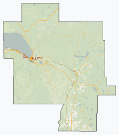
The Municipal District of Lesser Slave River No. 124 is a municipal district (MD) in north-central Alberta, Canada. Its municipal office is located in the Town of Slave Lake. Located in Census Division 17, the MD takes its name from Lesser Slave River, which drains Lesser Slave Lake into the Athabasca River.
Geography
Communities and localities
| The following urban municipalities are surrounded by the MD of Lesser Slave River No. 124.[3]
| The following hamlets are located within the MD of Lesser Slave River No. 124.[3]
|
The following localities are located within the MD of Lesser Slave River No. 124.[4]
- Localities
|
- Other places
Demographics
In the 2021 Census of Population conducted by Statistics Canada, the MD of Lesser Slave River No. 124 had a population of 2,861 living in 1,169 of its 1,500 total private dwellings, a change of 2.1% from its 2016 population of 2,803. With a land area of 10,041.79 km2 (3,877.16 sq mi), it had a population density of 0.3/km2 (0.7/sq mi) in 2021.[2]
The population of the Municipal District of Lesser Slave River No. 124 according to its 2020 municipal census is 2,811,[5] a -8.6% change from its 2014 municipal census population of 3,074.[6]
In the 2016 Census of Population conducted by Statistics Canada, the MD of Lesser Slave River No. 124 had a population of 2,803 living in 1,090 of its 1,310 total private dwellings, a -4.3% change from its 2011 population of 2,929. With a land area of 10,074.39 km2 (3,889.74 sq mi), it had a population density of 0.3/km2 (0.7/sq mi) in 2016.[7]
Education
Southern parts of the MD are within Pembina Hills Public Schools, which formed in 1995 as a merger of three school districts.[8]
See also
References
- ^ "Municipal Officials Search". Alberta Municipal Affairs. May 9, 2019. Retrieved October 1, 2021.
- ^ a b c "Population and dwelling counts: Canada, provinces and territories, and census subdivisions (municipalities)". Statistics Canada. February 9, 2022. Retrieved February 9, 2022.
- ^ a b "Specialized and Rural Municipalities and Their Communities" (PDF). Alberta Municipal Affairs. January 12, 2022. Retrieved January 21, 2022.
- ^ "Standard Geographical Classification (SGC) 2006, Economic Regions: 4817033 - Lesser Slave River No.124, geographical codes and localities, 2006". Statistics Canada. March 5, 2010. Retrieved August 11, 2012.
- ^ 2019 Municipal Affairs Population List (PDF). Alberta Municipal Affairs. December 2019. ISBN 978-1-4601-4623-1. Retrieved July 1, 2021.
- ^ 2015 Municipal Affairs Population List (PDF). Alberta Municipal Affairs. ISBN 978-1-4601-2630-1. Retrieved February 17, 2016.
- ^ "Population and dwelling counts, for Canada, provinces and territories, and census subdivisions (municipalities), 2016 and 2011 censuses – 100% data (Alberta)". Statistics Canada. February 8, 2017. Retrieved February 8, 2017.
- ^ "Our Division". Pembina Hills Public Schools. Retrieved August 25, 2019.
5310 - 49th Street Barrhead, Alberta T7N 1P3
External links
- Official website

Places adjacent to Municipal District of Lesser Slave River No. 124 | ||||||||||||||||
|---|---|---|---|---|---|---|---|---|---|---|---|---|---|---|---|---|
| ||||||||||||||||


- v
- t
- e
Subdivisions of Alberta
service areas
municipalities
municipalities
- Crowsnest Pass, Municipality of
- Jasper, Municipality of
- Lac La Biche County
- Mackenzie County
- Strathcona County
- Wood Buffalo, Regional Municipality of
 Category
 Canada portal
 WikiProject


