Martin, South Carolina
Unincorporated community in South Carolina, United States
33°4′9″N 81°28′35″W / 33.06917°N 81.47639°W / 33.06917; -81.4763929836
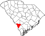
Martin is an unincorporated community in northwestern Allendale County, South Carolina, United States. It lies along SC 125 northwest of the town of Allendale, the county seat of Allendale County.[2] Its elevation is 92 feet (28 m).[1] Although Martin is unincorporated, it has a post office, with the ZIP code of 29836.[3]
History
The Allendale Chert Quarries Archeological District was added to the National Register of Historic Places in 1985.[4]
References
- ^ a b c U.S. Geological Survey Geographic Names Information System: Martin, South Carolina
- ^ Rand McNally. The Road Atlas '08. Chicago: Rand McNally, 2008, p. 92.
- ^ Zip Code Lookup
- ^ "National Register Information System". National Register of Historic Places. National Park Service. July 9, 2010.
- v
- t
- e
Municipalities and communities of Allendale County, South Carolina, United States
County seat: Allendale
communities
- Appleton
- Martin
- South Carolina portal
- United States portal
Authority control databases | |
|---|---|
| International |
|
| National |
|
 | This South Carolina state location article is a stub. You can help Wikipedia by expanding it. |
- v
- t
- e


