Delaware Mountains
31°29′10″N 104°37′28″W / 31.486244°N 104.624374°W / 31.486244; -104.624374Dimensions Length 83 mi (134 km) N/S Width 106 mi (171 km) E/W Area 4,761 sq mi (12,330 km2) Geography Country United States State Texas 
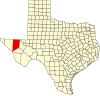
The Delaware Mountains are a mountain range in the U.S. state of Texas, spanning part of Culberson County.[1] The highest point in the range is the Delaware Benchmark at an elevation of 5,888 feet (1,795 m) above sea level.[2][3] The range extends south-southeast from Guadalupe Pass at the southern extent of the Guadalupe Mountains and Guadalupe Mountains National Park. The range is formed by horizontal layers of limestone, sandstone, and shale that were deposited 250 million years ago during the Permian that now encompass the Delaware Mountain Formation. The range is named for the Lenape, who are also known as the Delaware Indians.[4] The Delaware Mountain Wind Energy Center is a 28.5 megawatt wind farm that was constructed on the northern portion of the range in 1999 and is operated by NextEra Energy Resources.[5]
See also
- Beach Mountains
- Delaware Basin
- Delaware River
- El Capitan (Texas)
- Guadalupe Peak
- McKittrick Canyon
- Trans-Pecos
- Van Horn, Texas
References
Wikimedia Commons has media related to Delaware Mountains.
- ^ "Delaware Mountains". Geographic Names Information System. United States Geological Survey, United States Department of the Interior. Retrieved August 10, 2014.
- ^ "Delaware Mountains". Peakbagger.com. Retrieved August 10, 2014.
- ^ "Delaware Benchmark, Texas". Peakbagger.com. Retrieved August 10, 2014.
- ^ "Delaware Mountains". Texas State Historical Association. Retrieved August 10, 2014.
- ^ "Delaware Mountain Wind Energy Center" (PDF). NextEra Energy Resources. Archived from the original (PDF) on August 12, 2014. Retrieved August 10, 2014.
{{cite journal}}: Cite journal requires|journal=(help)
- v
- t
- e
- Bush Mountain
- El Capitan
- Guadalupe Peak
- Packsaddle Mountain
- Enchanted Rock
- Bachelor Peak
- Bare Butte
- Beach Mountains
- Carpenter Mountain
- Castle Peak
- Chalk Mountains
- Chinati Mountains
- Christmas Mountains
- Cusseta Mountain
- Davis Mountains
- Delaware Mountains
- Double Mountains
- Granite Mountain
- Greenwood Mountain
- Hairy Knob
- Las Moras Mountain
- Needle Peak (Brewster County)
- Needle Peak (Presidio County)
- Palo Pinto Mountains
- Rattlesnake Point
- Round Top Mountain
- Sierra del Carmen
- Sierra Diablo
- Sierra Vieja
- Slipdown Mountain
- Tackett Mountain
 | This article about a location in Culberson County, Texas is a stub. You can help Wikipedia by expanding it. |
- v
- t
- e


