Bmakine
Village in Aley District in the Mount Lebanon Governorate of Lebanon
Town in Mount Lebanon, Lebanon
Bmakine بمكين | |
|---|---|
Town | |
| 33°47′49″N 35°34′13″E / 33.79694°N 35.57028°E / 33.79694; 35.57028 | |
| Country | Lebanon |
| Governorate | Mount Lebanon |
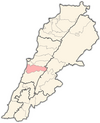
| District | Aley |
| City | Aley |
| Area | |
| • Total | 1.11 km2 (0.43 sq mi) |
| Elevation | 700 m (2,300 ft) |
| Time zone | UTC+2 (EET) |
| • Summer (DST) | UTC+3 (EEST) |
| ISO 3166 code | LB |
Bmakine (Arabic: بمكين) is a village in the Aley District of Lebanon. It is 700 meters above sea level.[1]
Location and geography
Bmakine lies on a hill in Aley, overlooking the Mediterranean sea from the west, 20 minutes away from Beirut.
History
In 1838, Eli Smith noted the place, called Bmikkin, located in El-Ghurb el-Fokany, upper el-Ghurb.[2]
See also
References
- ^ a b c Bmakine, Localiban
- ^ Robinson and Smith, 1841, vol 3, 2nd appendix, p. 191
Bibliography
- Robinson, E.; Smith, E. (1841). Biblical Researches in Palestine, Mount Sinai and Arabia Petraea: A Journal of Travels in the year 1838. Vol. 3. Boston: Crocker & Brewster.
External links
- Bmakine, Localiba
- v
- t
- e

Capital: Aley
- Aaytat
- Ain Aanoub
- Ainab
- Ain Drafil
- al-Azzounieh
- Abey
- Aghmeed
- Ain Dara
- Ain Ksour
- Aley
- Aramoun
- Baawerta
- Baissour
- Basateen
- Bdadoun
- Bechamoun
- Bhamdoun
- Binnay
- Bmakine
- Bmahray
- Bsous
- Charoun
- Chartoun
- Choueifat
- Houmal
- Kahale
- Kaifun
- al-Nreijat
- Nabaa Al Safa
- Qmatiye
- Ramlieh
- Rechmaya
- Sawfar
- Shemlan
- Souk El Gharb
- Silfaya

 | This Lebanon location article is a stub. You can help Wikipedia by expanding it. |
- v
- t
- e


